
Access to IMK/IAA generated MIPAS/Envisat data
Table of Contents
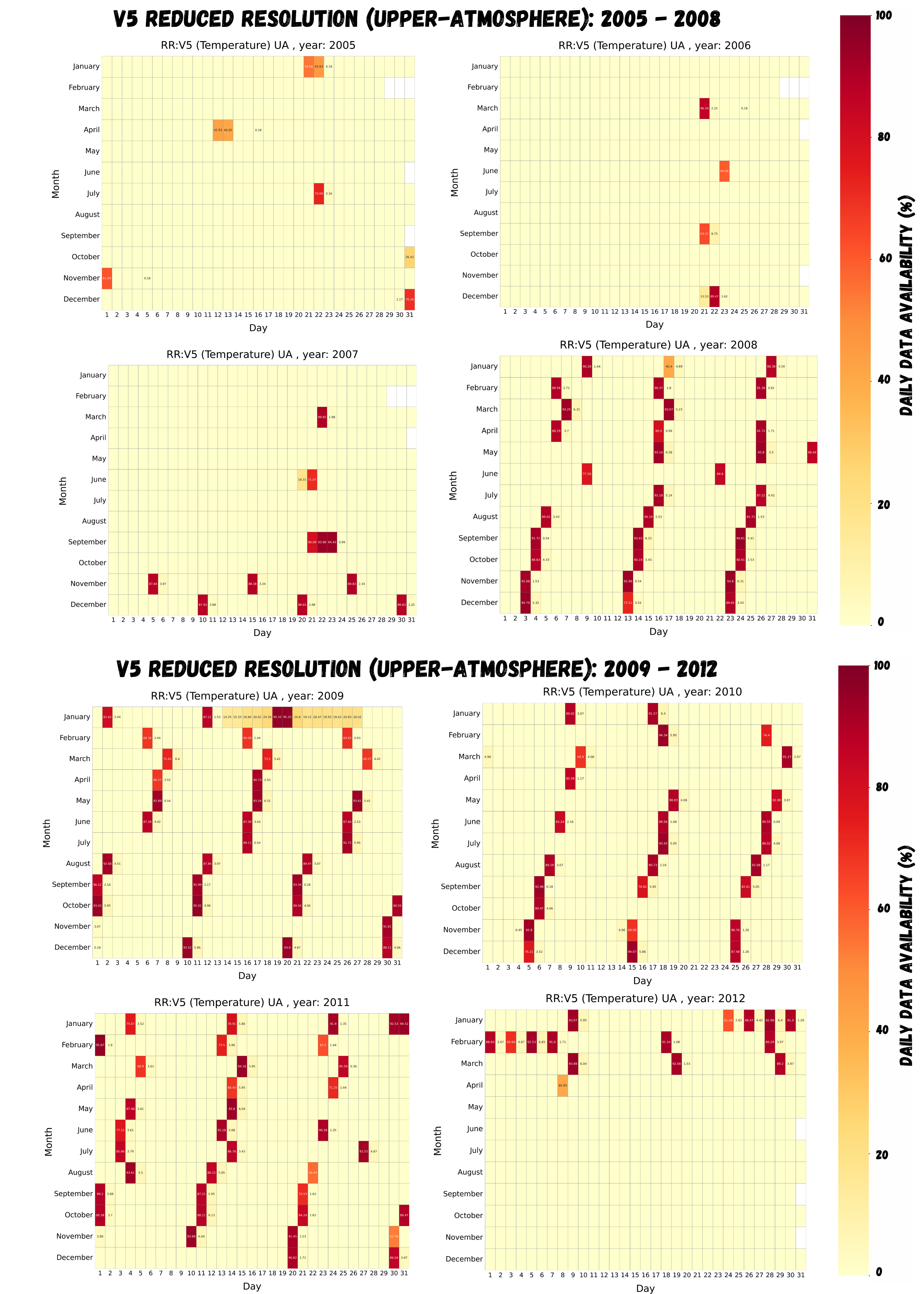
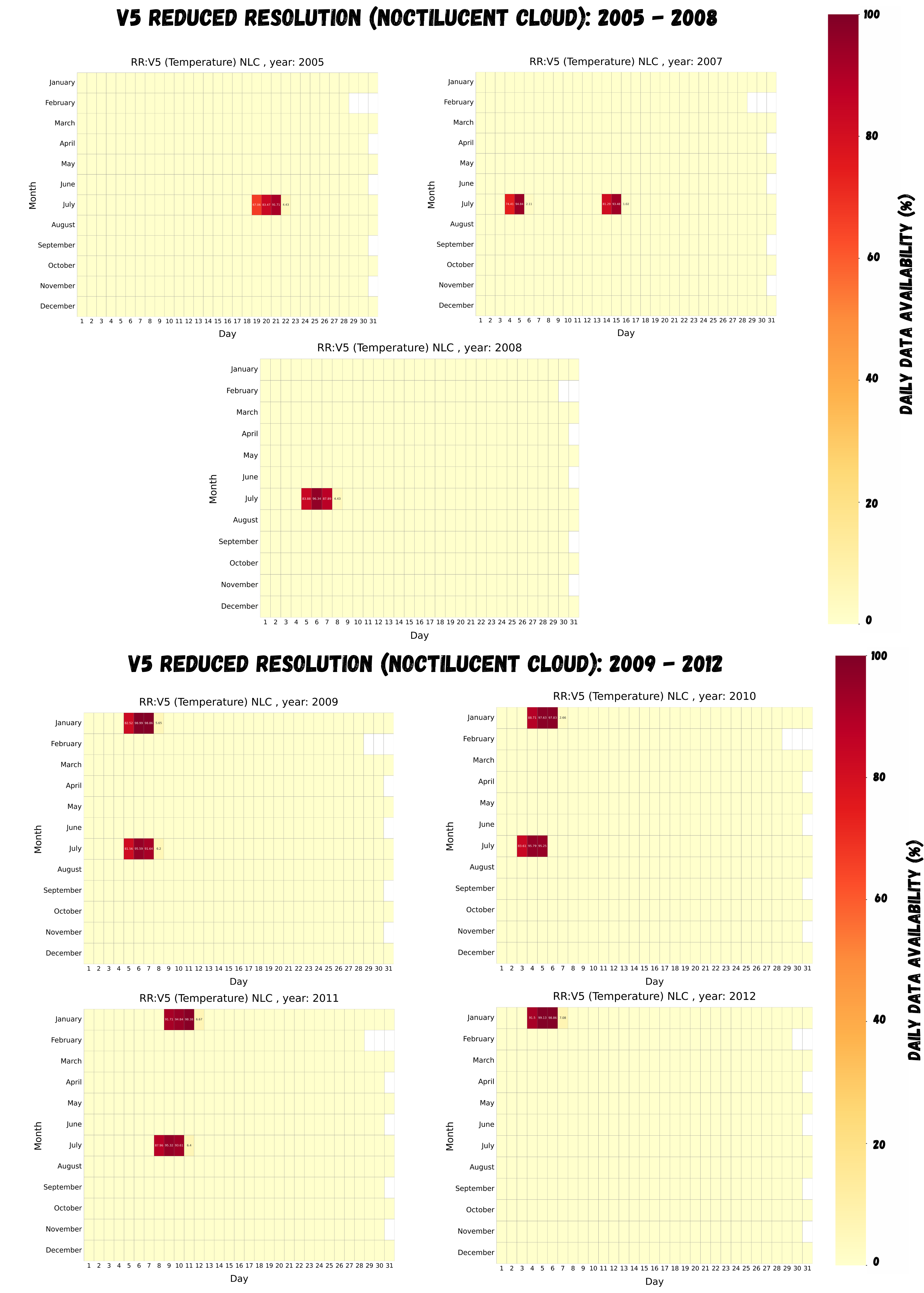
Available Data
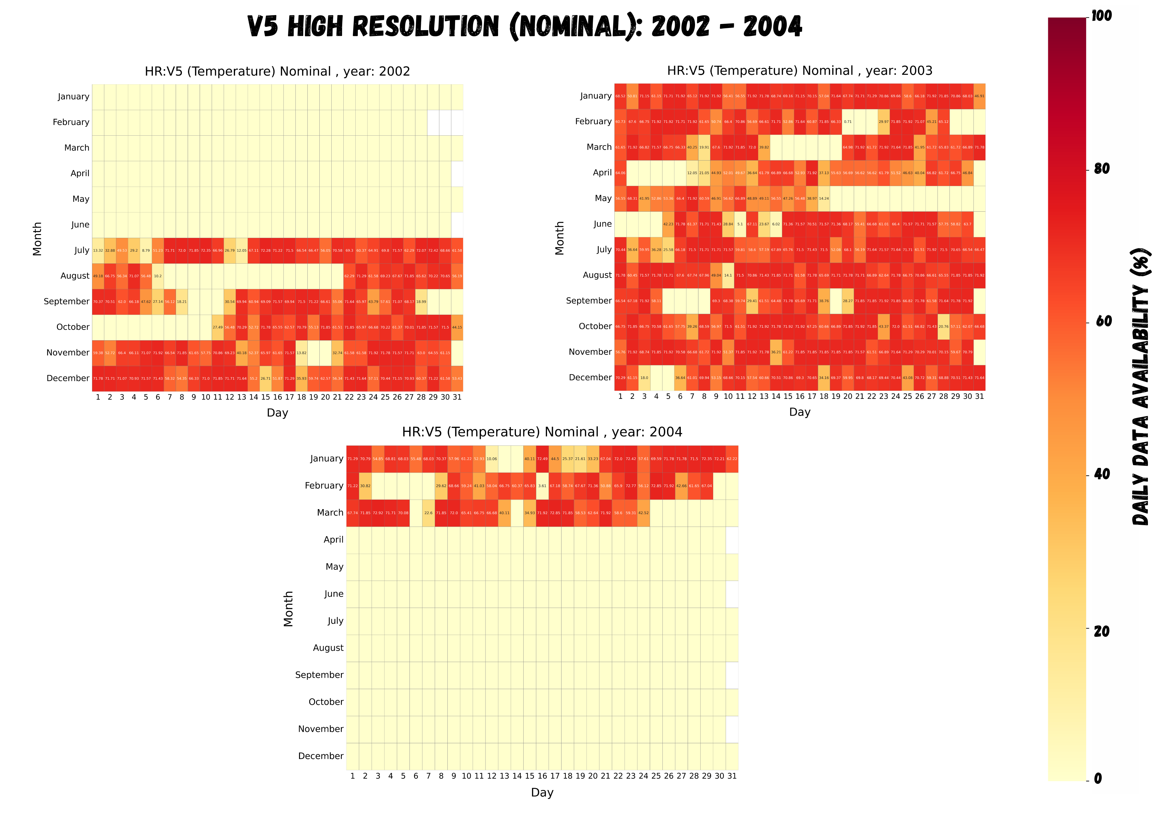
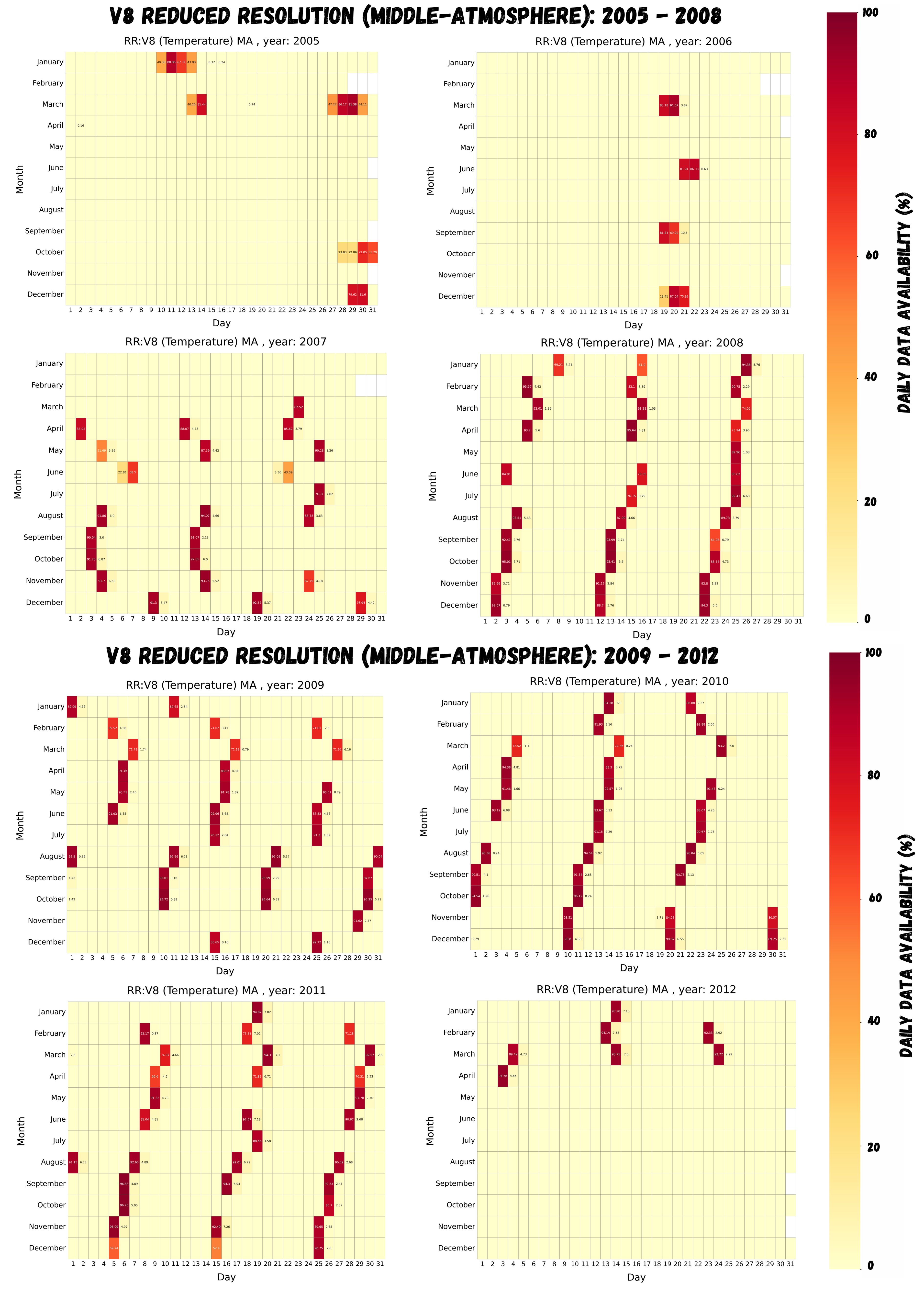
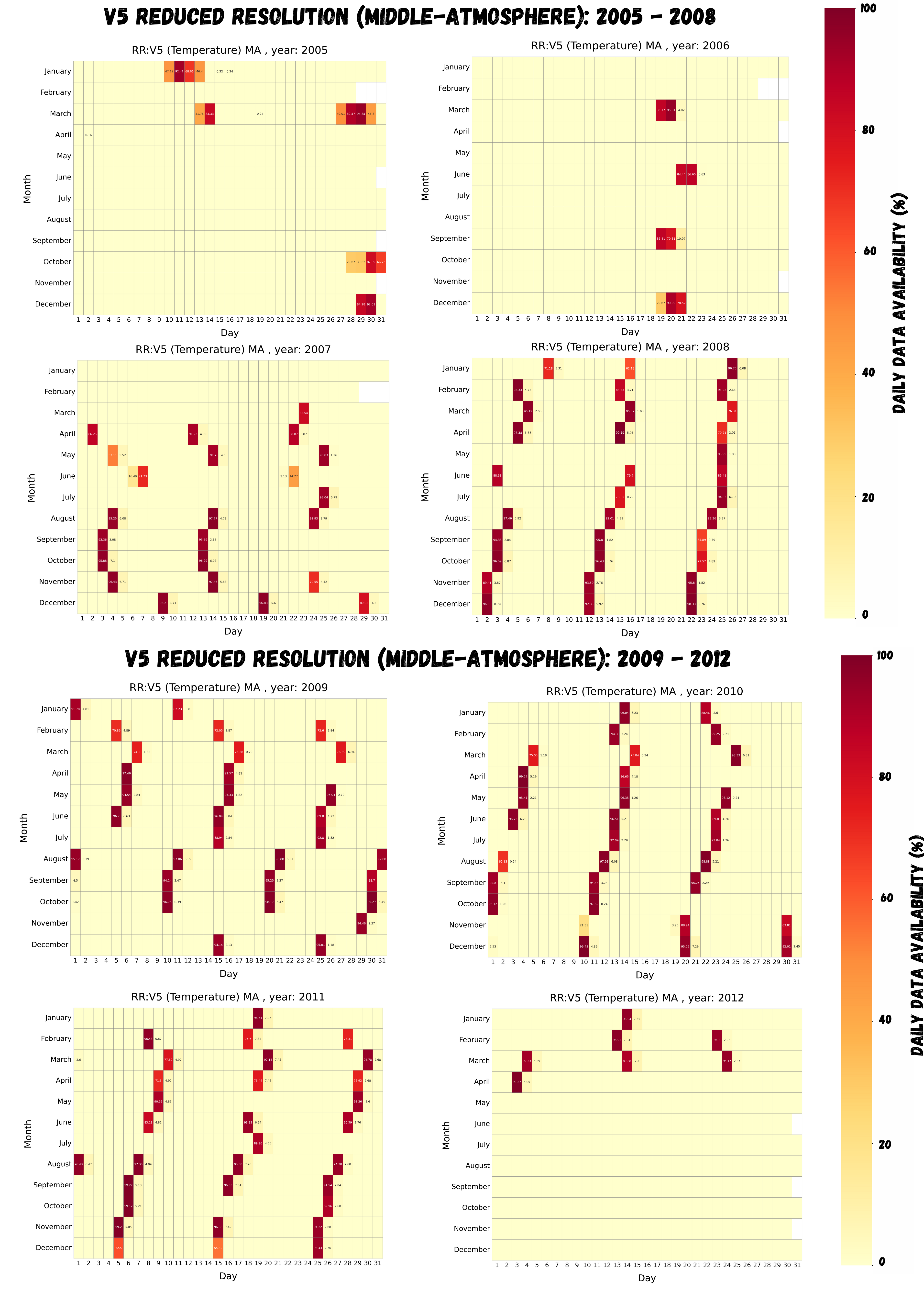
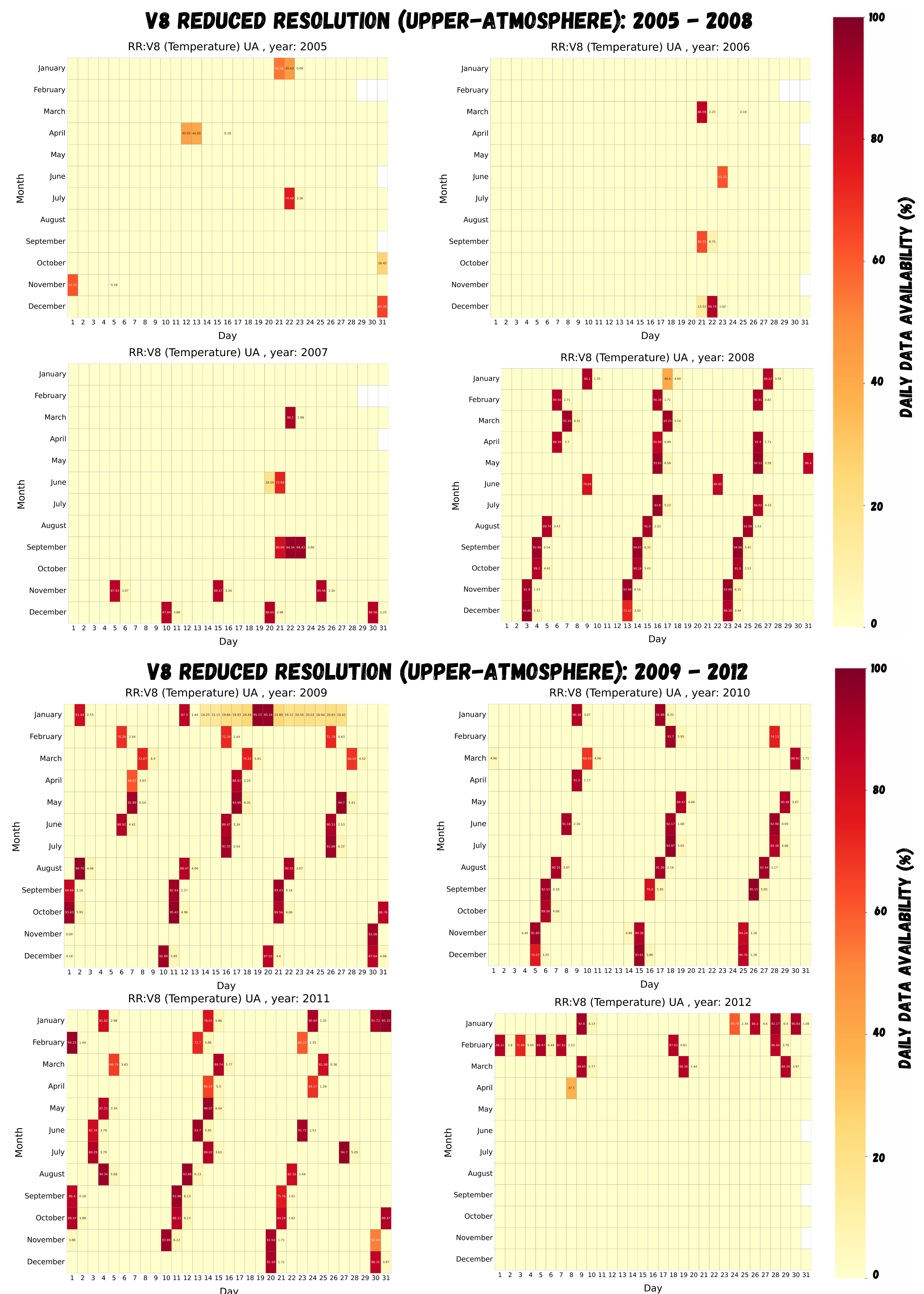
The MIPAS instrument measured in two time frames: from 2002 to 2004 in full spectral resolution and from 2005 to 2012 in reduced spectral resolution.
Measurements were conducted in different modes covering different altitude ranges:
| Mode | Altitude range | Version* (Click on the hyperlinks for the data availability calendar) |
|---|---|---|
| Upper-Troposphere Lower-Stratosphere (UTLS-1 New) | 5.5** - 49 km | V8R, V5R |
| Nominal (NOM) | 6** - 70 km | V8R, V8H, V5R, V5H |
| Middle-Atmosphere (MA) | 18 - 102 km | V8R, V5R |
| Upper-Atmosphere (UA) | 42 - 172 km | V8R, V5R |
| Noctilucent Clouds (NLC) | 39 - 102 km | V8R, V5R |
*Note:
V8R: Version 8, Reduced spectral resolution
V5R: Version 5, Reduced spectral resolution
V8H: Version 8, Full spectral resolution
V5H: Version 5, Full spectral resolution
**Lower altitude depends on the latitude.
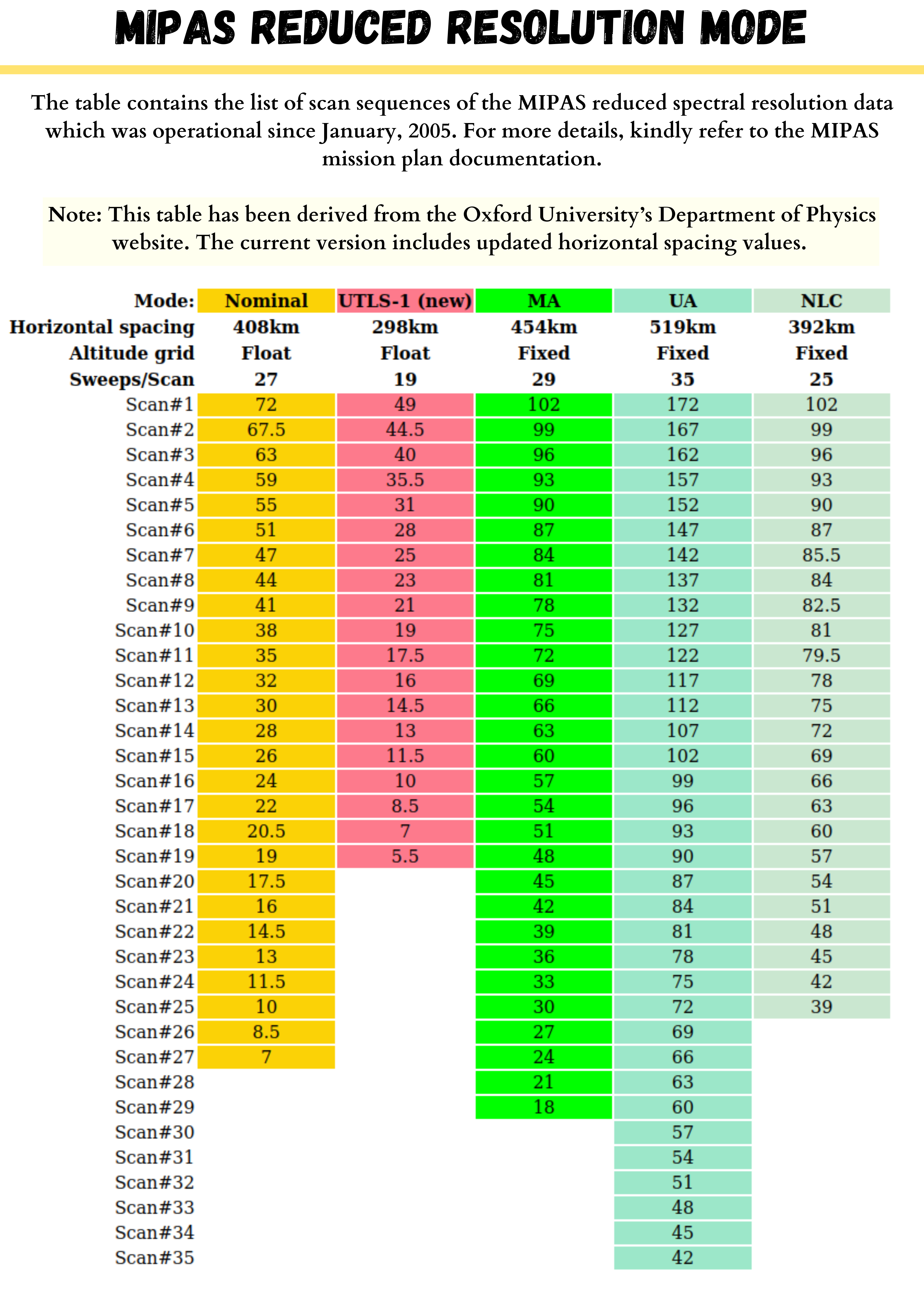
For details, please refer to Full Resolution Modes and Reduced Resolution Modes.
Further data includes monthly means of OCS (Glatthor+ (R) 2017) and SO₂ (Höpfner+ (R) 2013), 5 day means of SO₂ & ice particles (López-Puertas+ (R) 2009).
To better understand this data and their uncertainties, please refer to the methodological papers von Clarmann+ (R) 2022, von Clarmann+ (R) 2009, and von Clarmann+ (R) 2003.