
Validation of satellite products at permanent stations
Since 2005 the Land Surface Analysis – Satellite Application Facility (LSA-SAF) operationally retrieves Land surface temperature (LST) from measurements of the Spinning Enhanced Visible and Infrared Imager (SEVIRI) on board Meteosat Second Generation (MSG). The high temporal resolution of Meteosat and its long time series stretching from the past (1977) to the future (Meteosat Third Generation) make these data highly valuable for climate studies. In order to ensure that the target accuracy is consistently met, the LST obtained by LSA-SAF are continuously validated with in-situ measurements performed at four dedicated LST validation stations. Karlsruhe Institute of Technology (KIT) started LST validation in 2005 in Evora (Portugal) and set up two further stations in 2007 in Africa, a desert station (Gobabeb, Namibia) and a station in semiarid bush (Dahra, Senegal). A fourth station was established 2009 in the high altitude Kalahari semi-desert (Namibia). All stations are located in large, homogeneous areas and simultaneously measure ground and sky brightness temperature. Currently the four stations operated by KIT are the only long term LST validation stations in the field of view of METEOSAT and the only dedicated LST validation stations worldwide. The locations of the stations are indicated on the MSG/SEVIRI Earth disk (data courtesy: EUMETSAT) above.
The stations were designed to enable the continuous validation of LST products over several years; in order to minimize complications from spatial scale mismatch between the ground-based and the satellite sensors, the they were set up in large, thermally homogeneous and flat areas. Furthermore, the validation stations are located in different climate zones, which allows to analyse LST products under different atmospheric conditions and over broad temperature ranges.
LST validation and atmospheric stations
More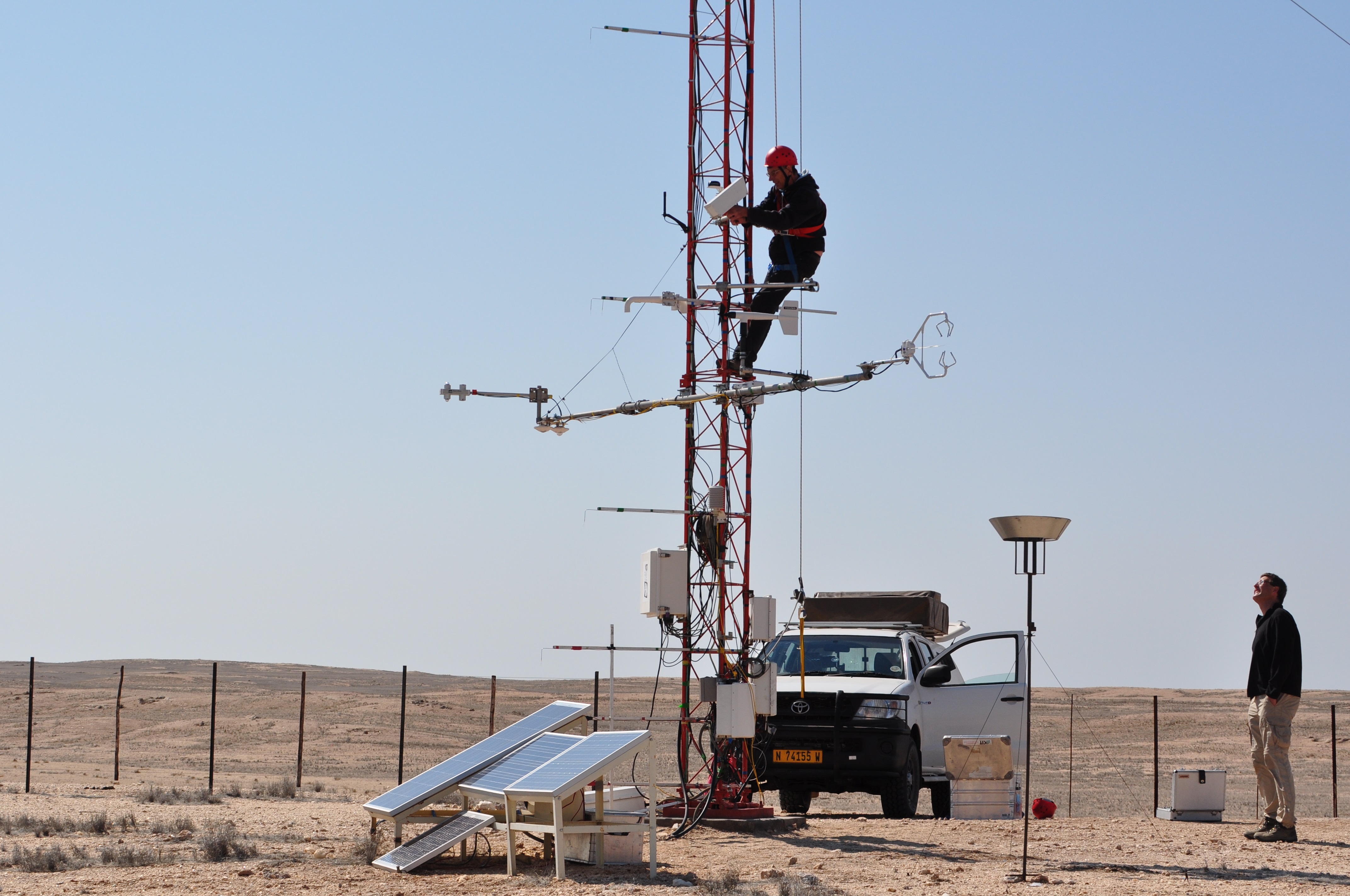
| Title | Contact | Funding | End Date |
|---|---|---|---|
| Dragon 5 co-operation on all-weather LST | data & logistic support by ESA and National Remote Sensing Centre of China (NRSCC) |
2024 |
|
| Copernicus Space Component Validation for Land Surface Temperature, Aerosol Optical Depth and Water Vapour Sentinel-3 Products Project (Copernicus LAW) |
Maria Martin |
European Union |
2022 |
| Thermal Infra-red Product Inter-comparison and Validation with FRM Radiometers (Lake Constance project) |
Maria Martin |
EUMETSAT |
2021 |
| Land Surface Temperature Climate Change Initiative (LST CCI+) |
Maria Martin
|
ESA |
2025 |
| Land Surface Analysis Satellite Applications Facility (LSASAF) | EUMETSAT |
||
| Fiducial Reference Temperature Measurements (FRM4STS) | ESA |
2017 |
|
| GlobTemperature | Maria Martin |
ESA |
2018 |